
Introduction
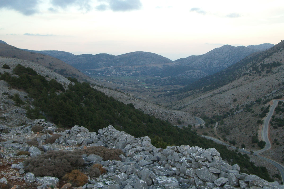
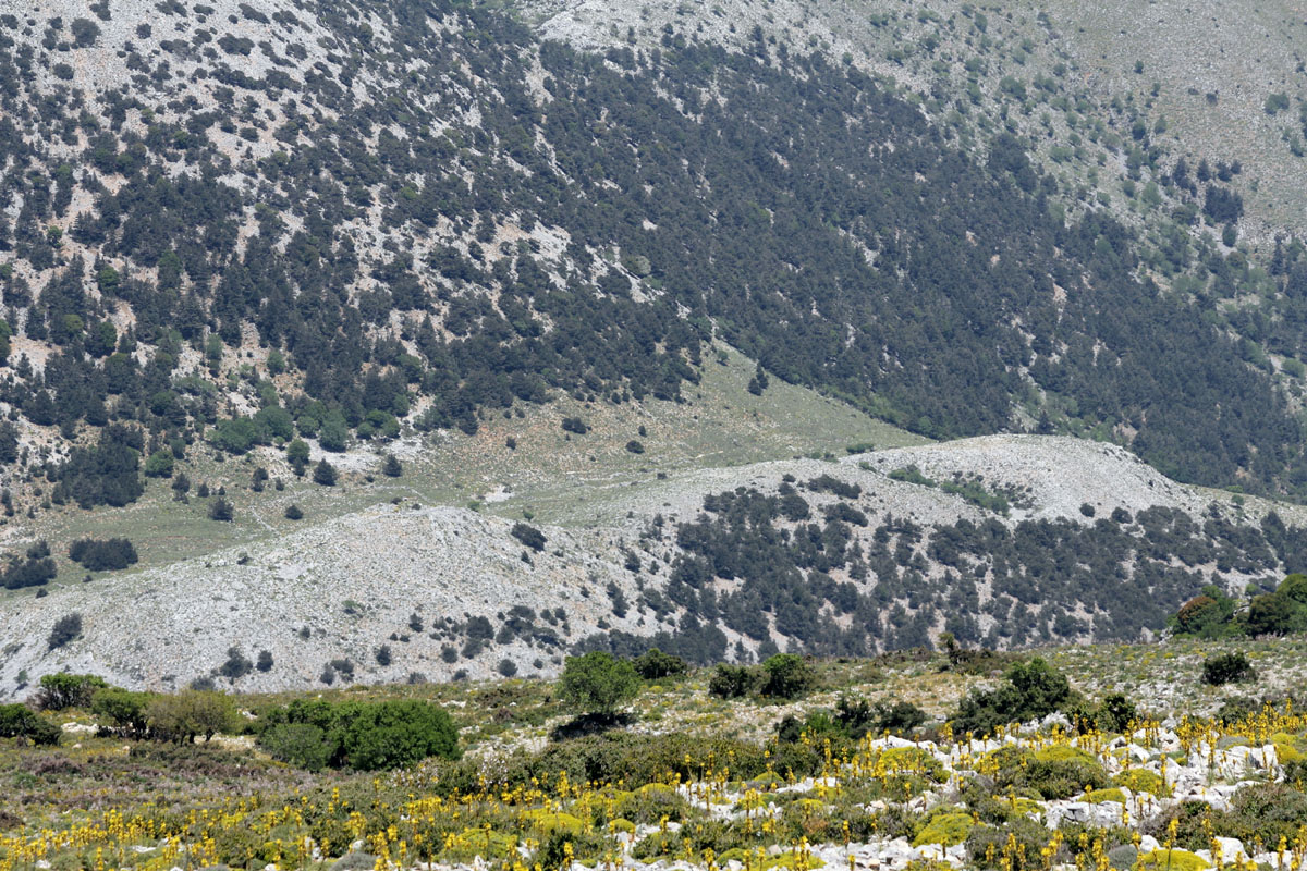
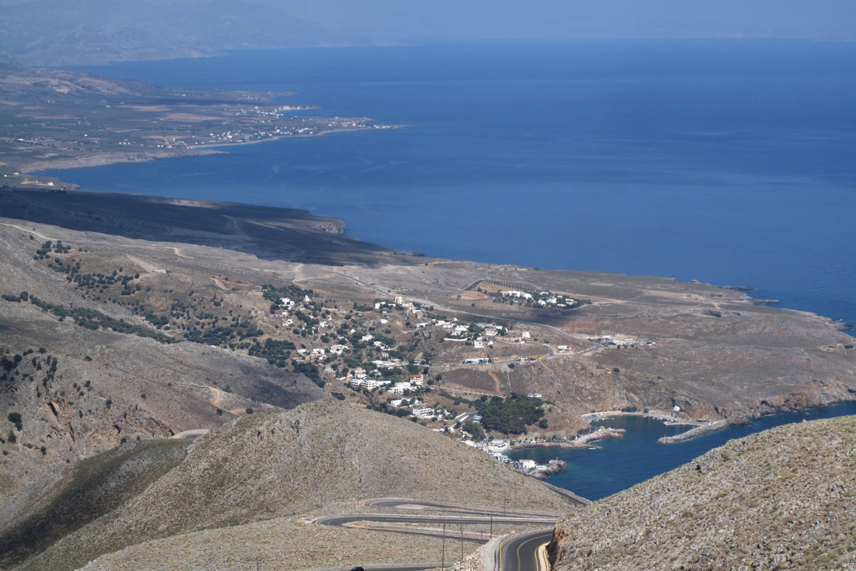
A visitor to Sfakia, as he comes by road through the pass of Katre and reaches the opening to the Askifou plateau, usually gets a good view of two ruined forts standing on two hill tops that overlook the plain below. This is the first evidence of a massive undertaking by the Turks, following the Cretan uprising of 1866, to build a large number of forts all around Crete and to station troops there so that they will become aware early of any attempt for a new uprising and stamp it out immediately.
These forts are known by their Greek names as koulés and koulédes in plural that derives from the Turkish word “koule” which means tower. These forts were built within sight of each other so that would enable the Turks to communicate by flags, fire or smoke signals from one fort to another and in many occasions with more than one fort. Some of these forts were large enough to accommodate a number of permanent troops, while others were small observation posts, with larger troop concentrations stationed in nearby larger forts.
The forts that were built around Sfakia were meant to communicate with those to the north of the island as well as those towards the east and the west along the south coast. The Apocoronas district, from where one approaches Sfakia, had some twenty forts, with the last two on the approach to Sfakia at Embrosneros. These communicated with the first fort that was built in Sfakia above the Krapi (Κράπη) plateau and then with the two at the northern end of the Askifou plateau.
The line of forts moved then in a southerly direction with possibly more forts at Askifou, then at Imbros and possibly above Asfendou and then down to the coast, in both an easterly and westerly direction.
Some of these forts were destroyed by the Sfakians during the 1878 uprising, some to be rebuilt by the Turks soon after. They were finally abandoned by the Turks upon their departure from Crete in 1898. For their historical background see note at the end of this presentation.
A group of regular visitors to Sfakia with interest in the district’s history, walking and photography have researched this historic development, found where some of the missing forts were, photographed them, and have put together this report. This is an updated report to the one published in 2014 and contains more and better pictures, as well as some updated information. There is still scope to further expand this study and hopefully this might occur in the not too distant future. Names of those that have participated and provided input to this study are listed at the end of this report.
Line up of Turkish Forts.
(From north moving south, then west to Agia Roumeli and then north to Omalos and west to Sougia)
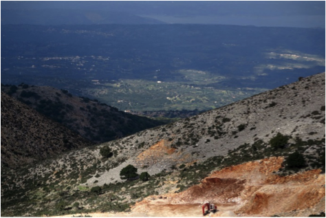
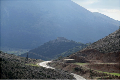
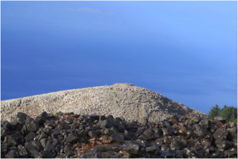
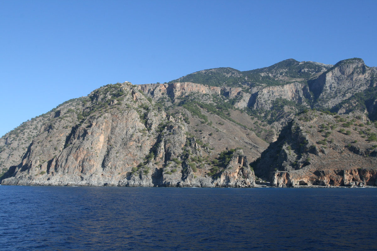
Emprosneros village. This was a Turkish stronghold where there were two forts. One was located at a location known as Tsouristra (θέσηΤσουρίστρα) and the second at Kimina (ύψωμα του Κιμινά) where today is located the water supply of the village. Pictures of the second location as well as the view towards the Rogdio peak, where the next fort was, are shown below. Similar view can be had from the other fort that is located less than one kilometre to the west, although this was not visited due to access issues. Coordinates of Kimina location are 35 20 31.3 N 24 12 01.4 E.
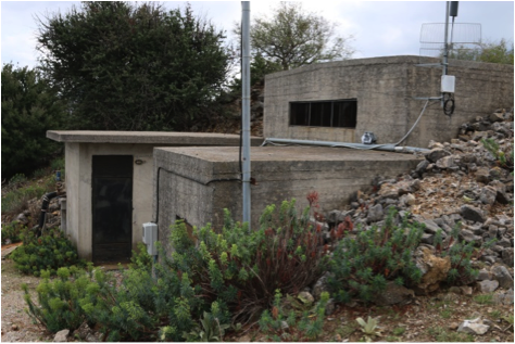
Water supply installation with ruins of fort besides it
Rogdio peak in the distance with earth excavations seen on the right of it
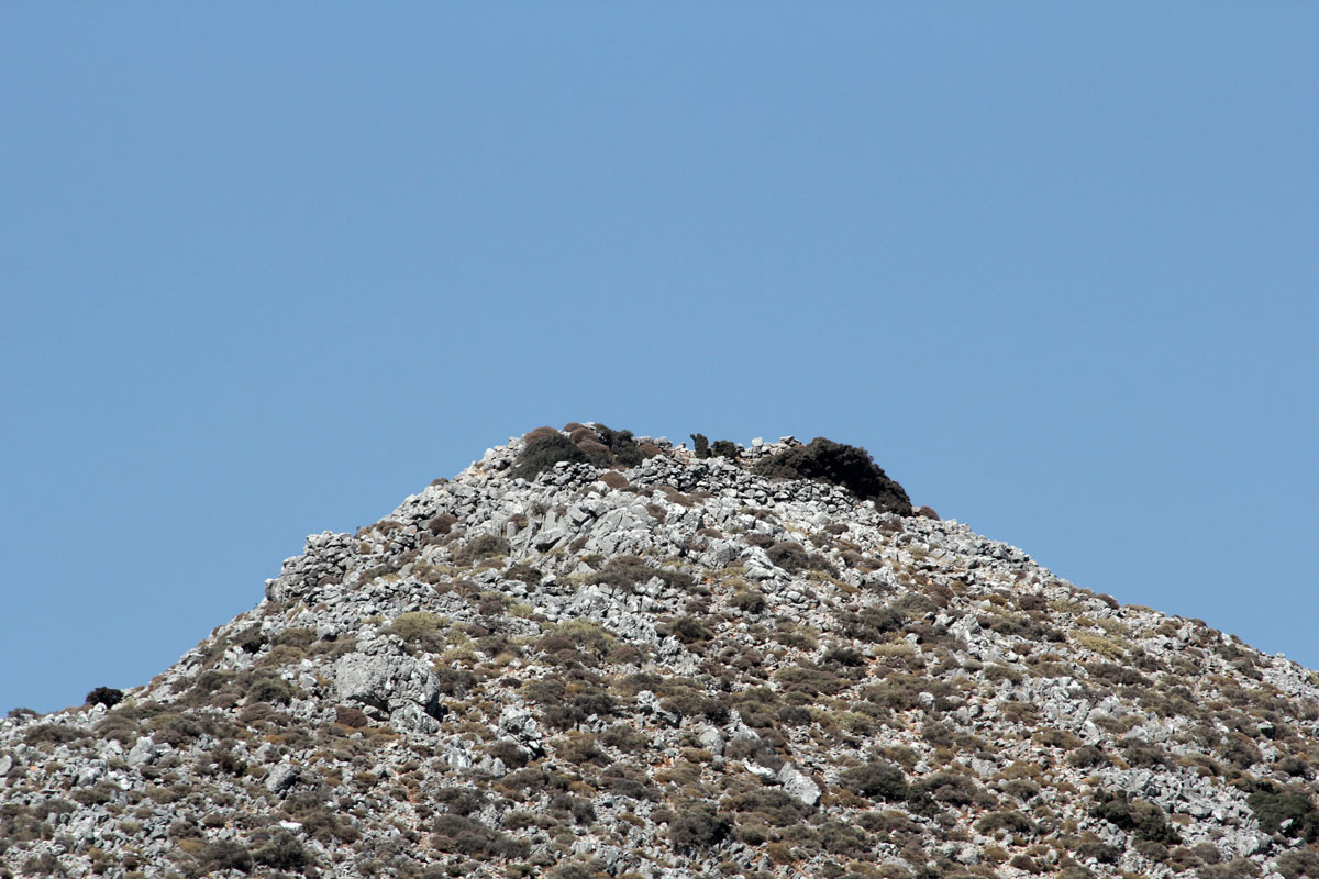
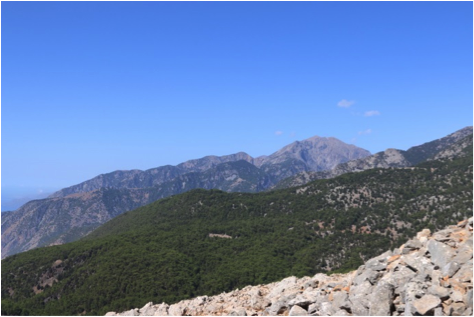
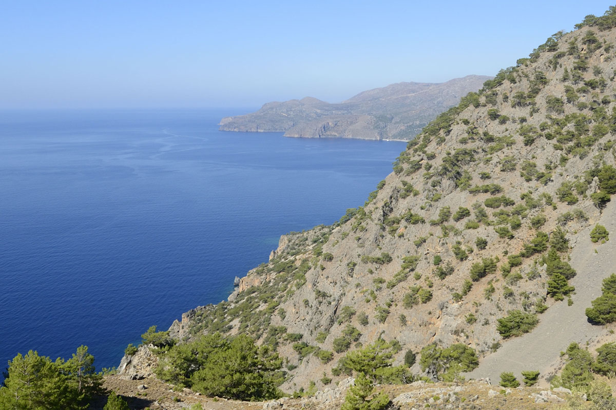
Above Krapi plateau. There are two possible locations. According to Plymakis[2] the observation post was at Rogdio (Ρογδιό). This is at 35 18’ 14.8” N, 24 11’ 49.7” E, at 814 m elevation. According to Kanakis Geronymakis[3] it was at Xylodema, just west of the Rogdio peak. The Xylodema location has not been explored yet. Clear line of sight to Embrosneros from Rogdio has been confirmed as well as line of sight to both forts at Askifou. The ruins at that location indicate that this was just an observation post manned by troops that were rotated from the forts at Askifou.
Rogdio from the road below
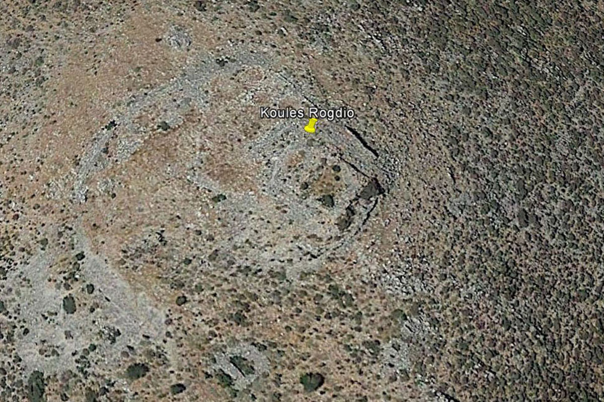
Satellite view
View north to Embrosneros
View south to Askifou
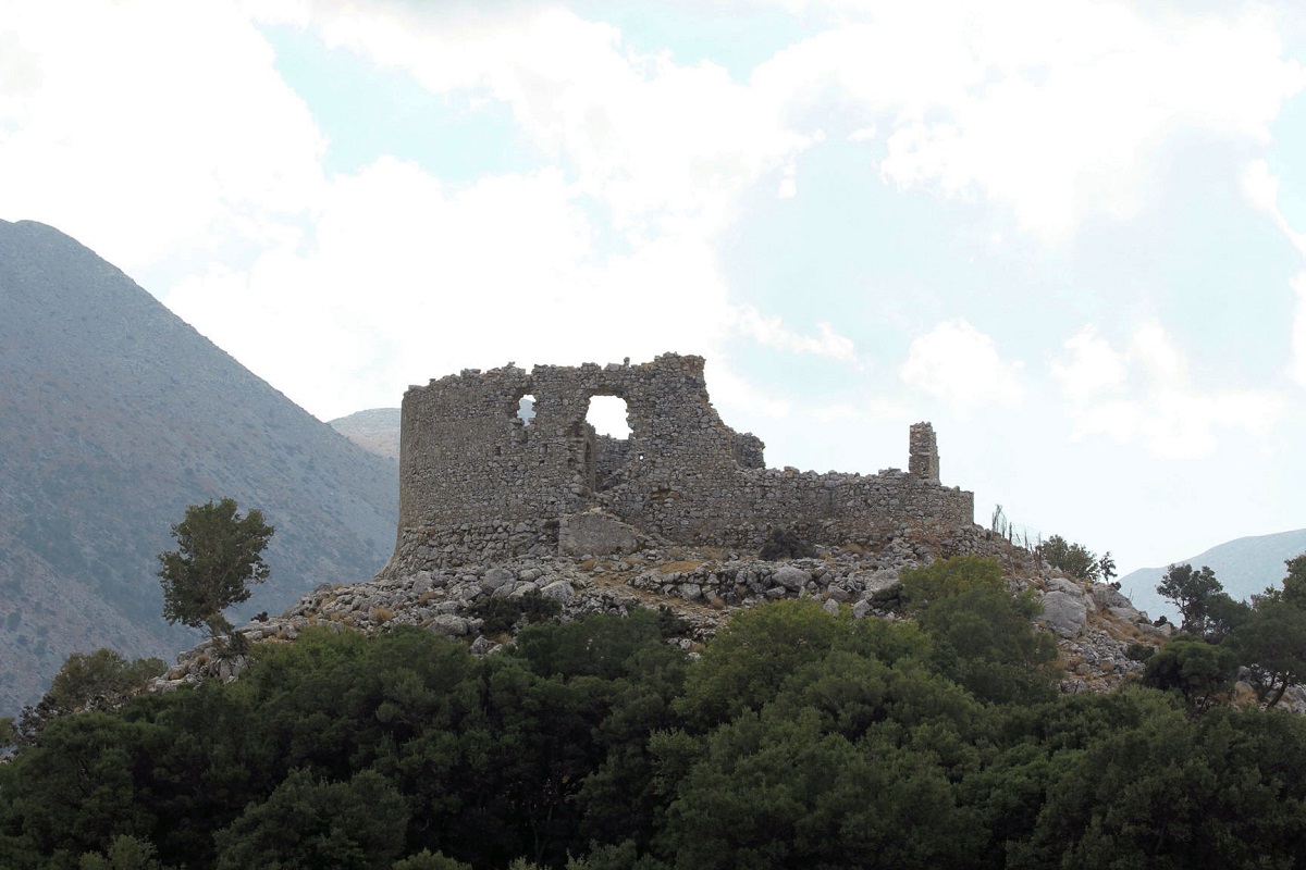
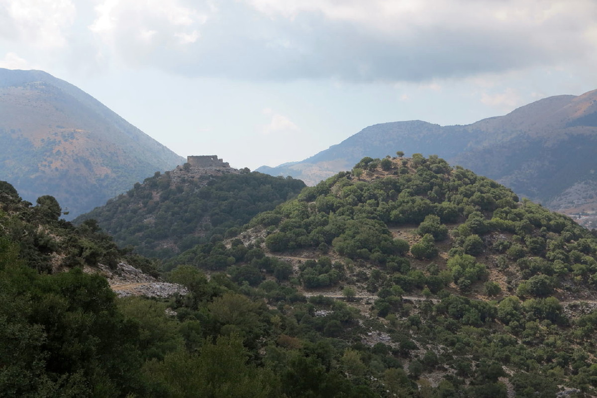
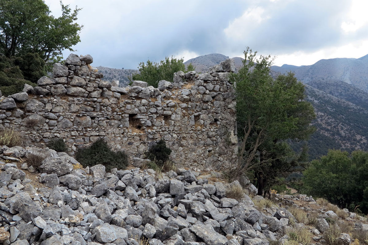
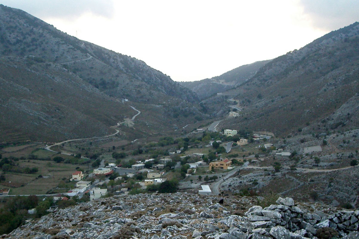
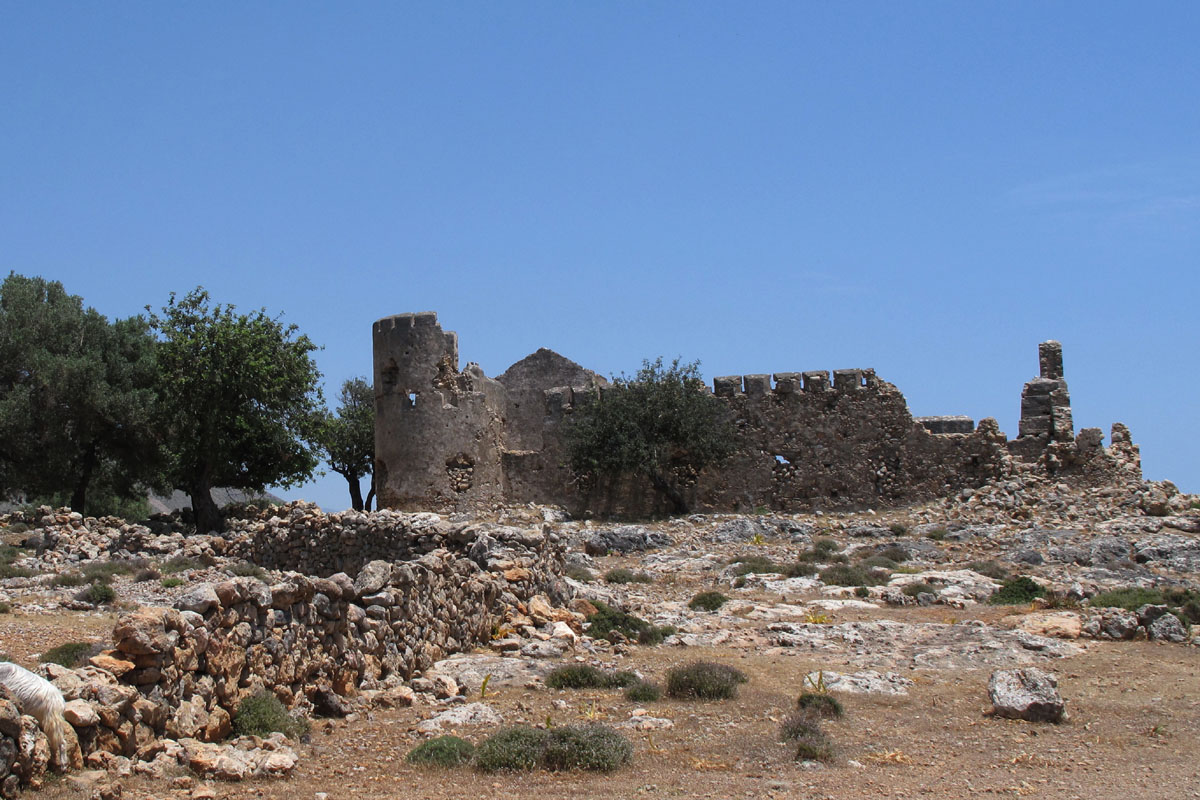
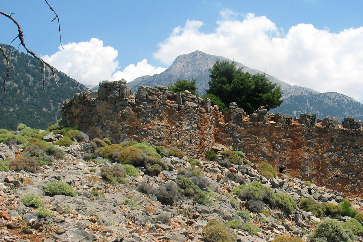
Askifou. There are two forts at the northern entrance to the Askifou plateau, at a location known as Plana (Πλανά) according to Kladou and Plymakis. Coordinates Northern, 35 17’ 37.4” N 24 11’ 33.7” E at 755 m elevation and Southern, 35 17’ 30.3” N 24 11’ 34.3” E at 760 m elevation.
Askifou two forts
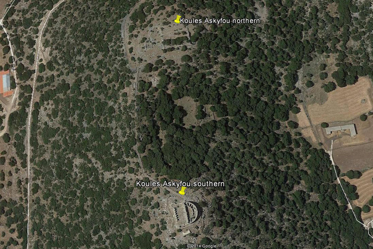
Satellite view
The two forts are dissimilar in design and state of repair. The northern one is of a square shape of about 30 meters each side divided into two levels of 30 by 15 meters each, where only the lower sections of the walls can be seen. The southern fort that is connected to the northern one by a paved roadway has two sections, a rectangular of about 25 by 15 meters and adjacent to it is a semicircle section divided into small enclosures, possibly rooms or storage compartments. The external walls and some of the internal walls still stand up but most of the render has fallen off, exposing the walls to the elements and their eventual collapse. There is tourist potential associated with these two forts but it would require funding that is not currently available.

Southern of the two forts
Northern of the two forts
Both these forts have a line of sight to Rogdio and towards south, all the way to Imbros, as it can be seen from the pictures below.
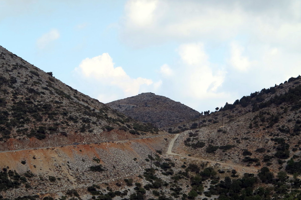
View north to Rogdio
View to south to Imbros fort
There are some other forts or defensive structures mentioned for this area that have not been located and photographed yet. These are:
Krouselia of Askifou (Κρουσέλιατα’ Ασκύφου) mentioned by Kladou. (Is this the same as Koproselia mentioned by Plymakis below?)
Tagdia peak (ΤαγδιάΚορφή) mentioned by Kladou.
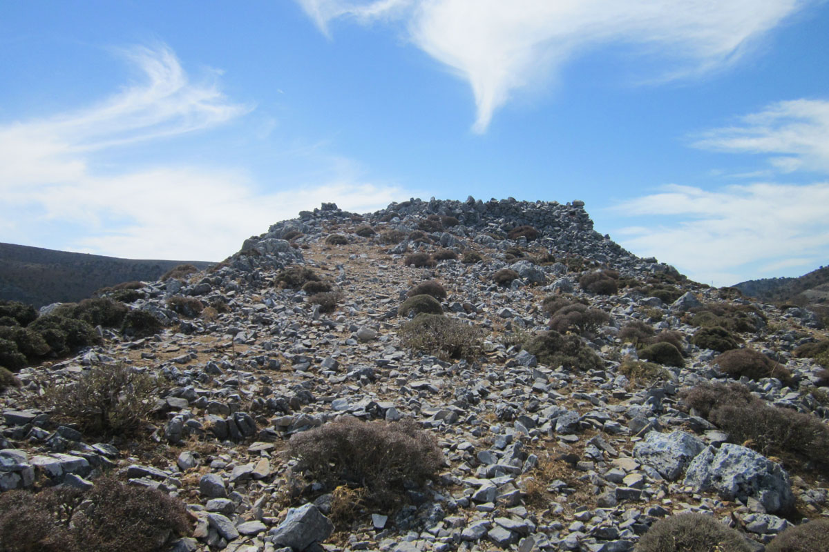
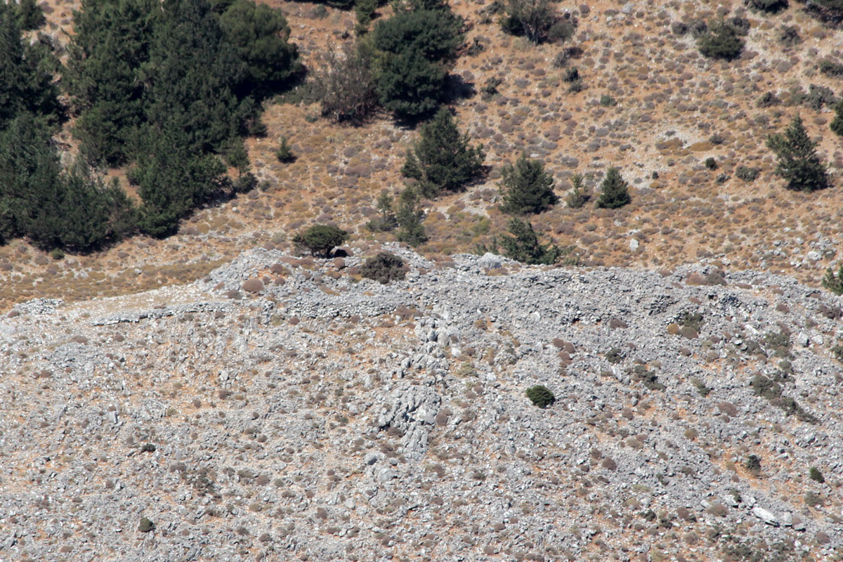
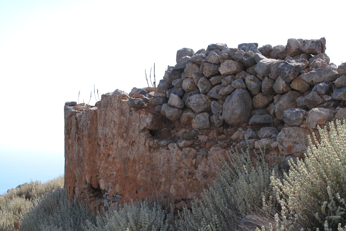
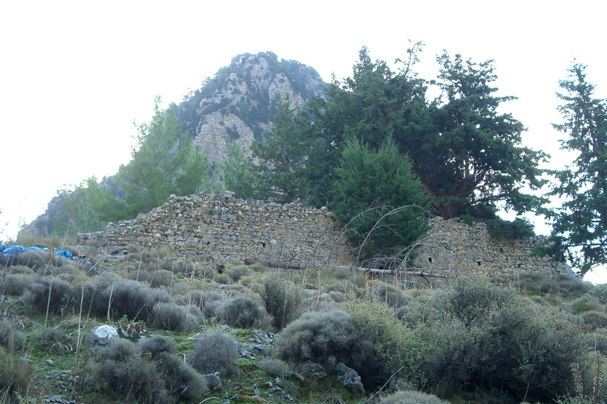
Imbros. There are a number of ruins in the vicinity of Imbros with clear views to the Askifou forts. The most likely location is west of the village at location at 35 15’ 37.6” N, 24 10’ 20.8” E, at 900 m elevation. There are a number of names by which this is referred to. Georonymakis refers to it as “στηςΊμπρουτοΣελί” while Plymakis refers to it as “ΝιπριώτικοςΚουλέςσταΚοπροσέλιατηςΊμβρου”. Alternatively they may be referring to different ruins that are in the same area.
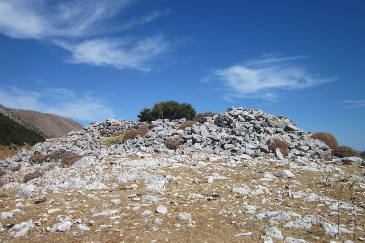
Imbros fort ruins
Imbros fort ruins
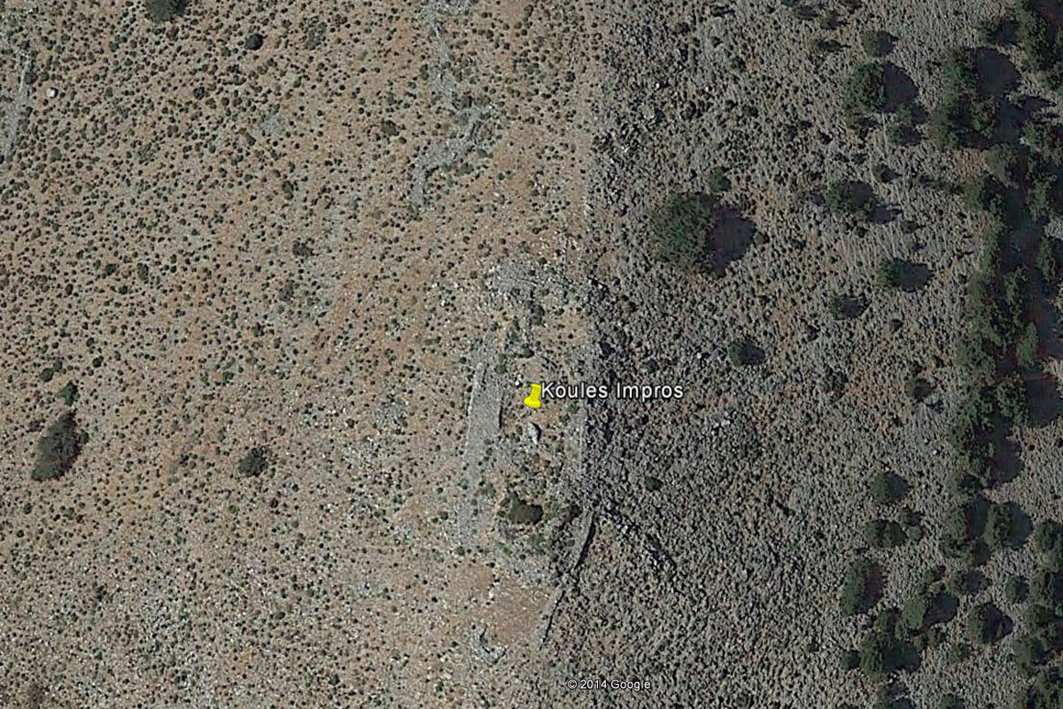
Satellite view
View from the road to Asfendou
View towards the Askifou forts
View south
From the ruins that can be seen today this structure was more an observation post rather than a fort with a permanent garrison. Troops must have been rotated there on a daily basis from the larger forts at Askifou which can be seen in the lower left photograph above. The distance between the two is only about 4 km making the exchange of the troops quite easy, not necessitating a larger permanent fort at the Imbros location.
From the lower right picture it is quite obvious that a view south to the coast and to Chora Sfakion was not possible from Imbros. Our research in earlier work by others on this subject and from our discussion with locals did not reveal where the next location of a fort or observation post might have been. After visiting a number of locations that were in view of Imbros and would have provided a view of Chora Sfakion it lead us to the conclusion that the location known as Kefala (Κεφάλα), between Imbros and Asfendou, was the most likely location.
There are other ruins in the Imbros vicinity. One of them is at a location about700 m SW of Lefkorotis Hotel and 220 m higher at 35 16’ 46.2” N 24 10’ 22.6” E, at 956 m elevation that has been referred as Koproselia by Plymakis and appears as Kombrossolia on an old WWII German map. This and others in the vicinity have not been visited or photographed but as all are further north of the one mentioned above they would not have provided a view south towards Chora Sfakion where the next forts were located.
The satellite view below indicates the possible locations that were explored that could have provided a view to both Imbros and south to Chora Sfakion.

The image above shows the location of the Kefala peak and its relation to the Imbros ruins as well as the Fidas mast installation and the peak with the radio dishes at Akones. From both Fidas and Akones, Chora Sfakion cannot be seen. Further to the east from Kefala one cannot see Imbros anymore, so our current view is that the ruins at Kefala represent the most likely location where another observation post was built to connect the south coast with observation posts and forts leading to the north coast of Crete.
Kefala ruins
View of Chora Sfakion
Imbros ruins view
Kambia view
View of Agia Ekaterini
View of fort location above Agios Ioannis
The locations shown in the above pictures all had forts or observation posts and all were within sight of Kefala. At Chora Sfakion the relevant fort was at the upper part of the village, at Tholos, just north of the church of Agioi Apostoloi, that can be seen in the above picture (upper right hand picture). The two pictures in the middle show the Imbros observation post ruins, on the left, and the communication masts at Kambia, on the right, where a fort and an observation post was located. The lower pictures above show the chapel of Agia Ekaterini, on the left, where a fort was located and on the right the picture shows the two peaks above the village of Agios Ioannis where a fort and an observation post were also located (these are discussed further down). Therefore, from this location, stationed troops could have had a direct line of view both towards the south and west, along the coast, as well as to Imbros which had a direct line of sight with forts to the north.
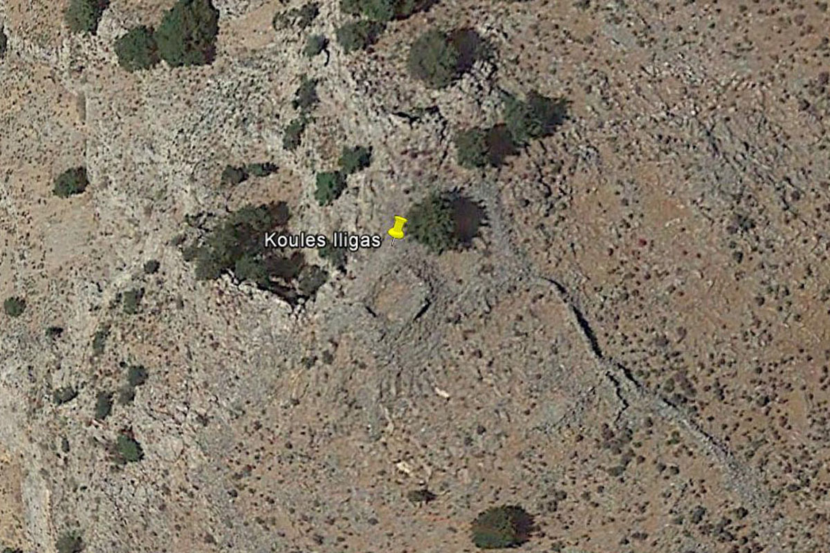
At the Kefala location, at 35 14’ 21.4 N, 24 11’ 17.4 E, at 1,171 m elevation, we have a fairly large flat stone lined area with a lot of rocks scattered at its perimeter that might indicate the ruins of such an observation post. The scattered rocks are similar to those that can be seen at the earlier locations at Rogdio as well as at Imbros and at another location above the Illingas gorge, west of the village of Chora Sfakion. But because of the fairly wide scatter of the rocks one cannot observe a well-defined pattern to justify with a high degree of confidence the size and shape of this structure. There is an old underground water storage tank nearby that could have assisted troops to be stationed there for longer periods but certainly there are no other indications of that being a more substantial structure.
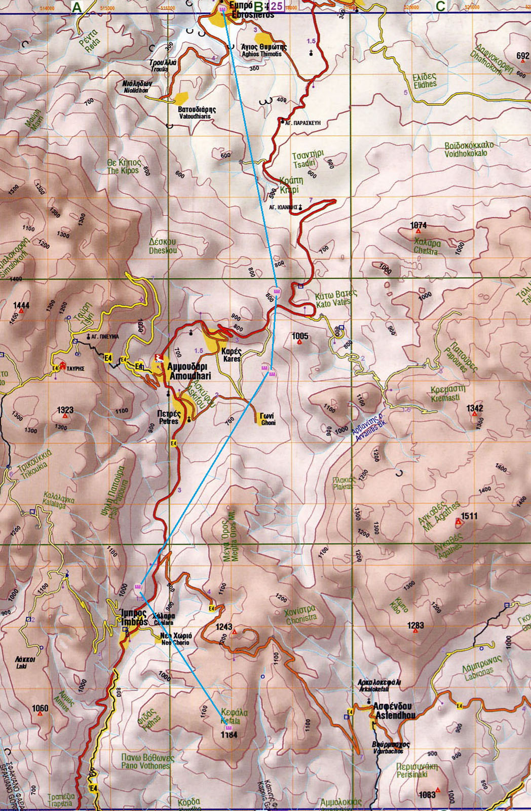
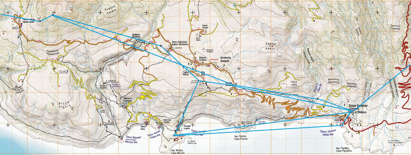
The map on the next page shows the location of the forts and observation posts that we have examined thus far as well as the relevant lines of sight (blue straight lines).
This study has not addressed, at this stage at least, whether there was a line of forts and observation posts linking the south coast of Sfakia, including Frangokastello, in an easterly direction with others in that area. This could be explored at a later date.
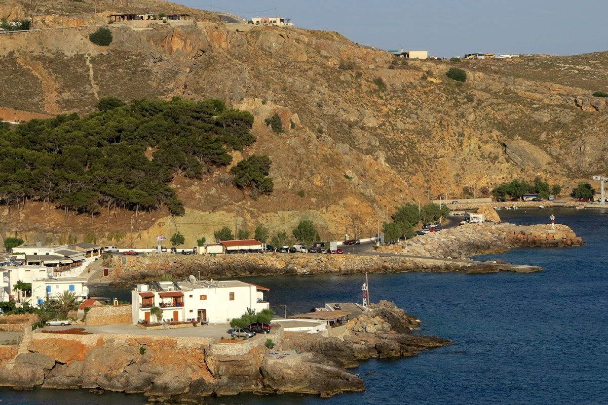
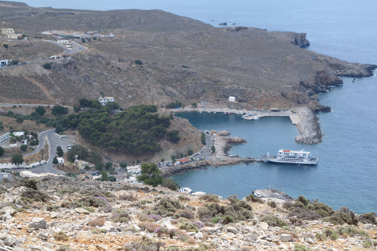
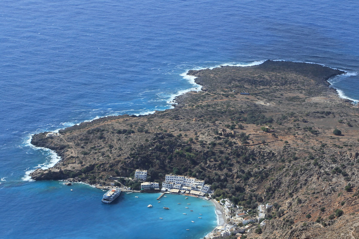
Chora Sfakion, the village of Sfakia. The Venetian era fort that was there was used by the Turks as one of two that they established in the village. This is at 35 12’ 00.7” N, 24 08’ 13.3” E, at 20 m elevation and has a line of sight towards the west to other forts and observation posts but not to Frangokastello. The fort has suffered a lot of damage, initially caused by the avenging Sfakians when the Turks left Crete and later when it was bombarded by the Germans in 1941 during the allied troop evacuation from the harbour below.
Lower fort view from road at Tholos
Lower fort view from road to Anopoli
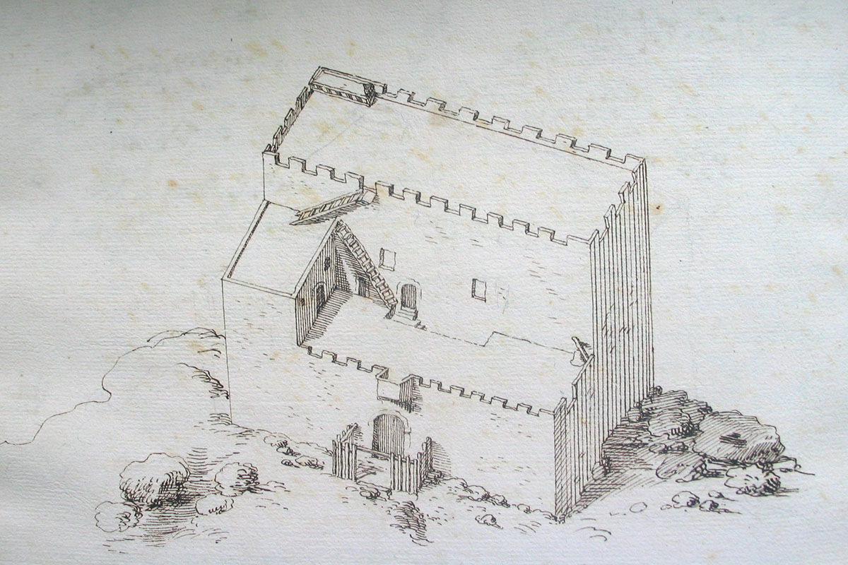
Venetian era sketch of lower fort
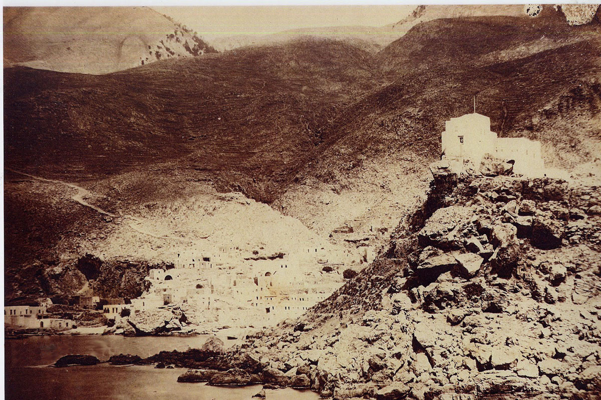
Late 19th century picture of the fort
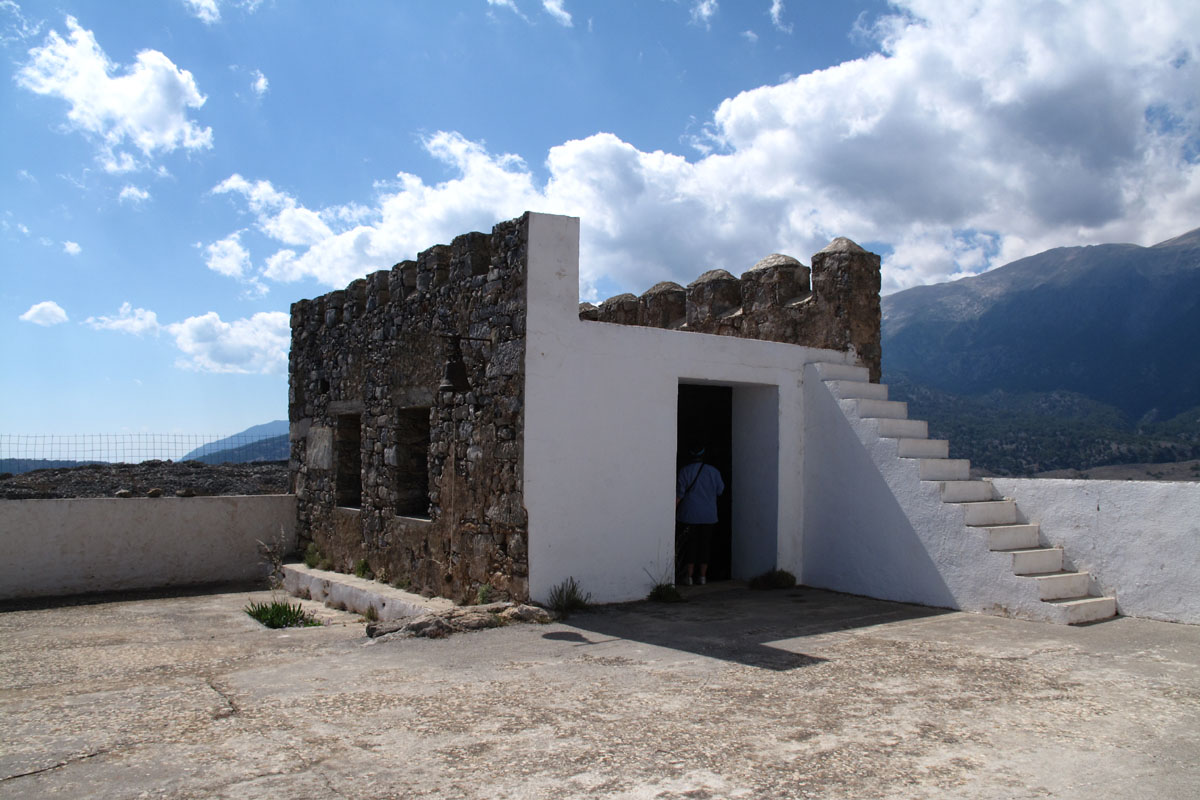
The Turks built also another larger fort further up in the village at the Tholos neighbourhood of the village, just above the church of Agioi Apostoloi at 35 12’ 10.0” N, 24 08’ 37.3” E, at 135 m elevation. There is not much to be seen today of this fort other than its foundations as the village’s water pumping facilities have been built on this location. From that fort, that according to reports from the late 1800s housed more than one hundred soldiers, there were clear lines of view towards a number of forts and observation posts to the west.
Foundations of Upper fort
View towards lower fort and the west
Illigas Gorge. At the eastern edge of the Illigas gorge, just a 1,000 meters direct distance from the lower fort and some 1,500 meters from the upper fort, at 35 12’ 26.1” N, 24 07’ 43.5” E, at 233 m elevation, there was an observation post. This was built to monitor any activity within the lower reaches of the gorge as these were not visible from any of the forts to the east or west of that location. Manning of the post would have been from troops stationed at the two forts in the village to the east.
Illigas observation post ruins
Satellite view of ruins
View towards the village of Sfakia
View towards the Kambia observation post
Anopoli. On the plateau of Anopoli there were a number of forts that we will visit following a western direction.
At Kambia neighbourhood in Anopolis there was an observation post at the eastern edge of the plateau at 35 12’ 36.28” N, 24 06’ 08.25” E, at 577 m elevation, overlooking the Chora Sfakion forts and the Illigas observation post with views all the way to Frangokastello to the east. Also there was a larger fort 100 meters to the west at 35 12’ 37.28” N, 24 06’ 03.32” E, at 582 m elevation where soldiers would have been based. Both are completely ruined with only some parts still showing the render that covered the walls.
Observation post ruins and view to the sea
Observation post view to Sfakia and Frangokastello
Ruins of main fort
View of Agia Ekaterini from main fort
Agia Ekaterini: Further to the west, just east of the ruins of ancient Anopoli, where there is the church of Agia Ekaterini, there was another fortified structure, but its size and shape is not known. In its place there is a reconstructed fort type of a building next to the church at 35 12’ 44.18” N 24 05’ 12.82” E at 656 m elevation. From there the fortifications at Kambia, to the east, as well as towards the west the forts at Agios Dimitrios as well as those above Agios Ioannis can be seen. And just below this location, the large fort at Loutro can be seen also.
Fort reconstruction at Agia Ekaterini location
View of Loutro and its fort from Agia Ekaterini
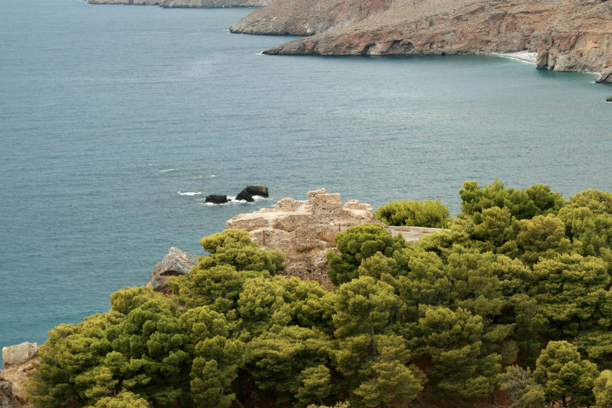
Loutro: Below Anopoli is the village of Loutro where a large fort was constructed as Loutro had been one of the centres of the Sfakian uprisings and being a sheltered port most supplies were being brought there for the rebels during the Turkish occupation. The fort is just above the village with views to Chora Sfakion and in direct sight from the fort at Agia Ekaterini. It is at 35 11’ 51.81” N 24 04’ 38.51” E at 54 m elevation. It is a substantial structure, at least two stories high, with a number of divided sections internally for storage and living quarters. It is in a reasonable condition and could provide tourist opportunities if adequate funding was available.
Western side of the fort
South side with views of the Agia Ekaterini location
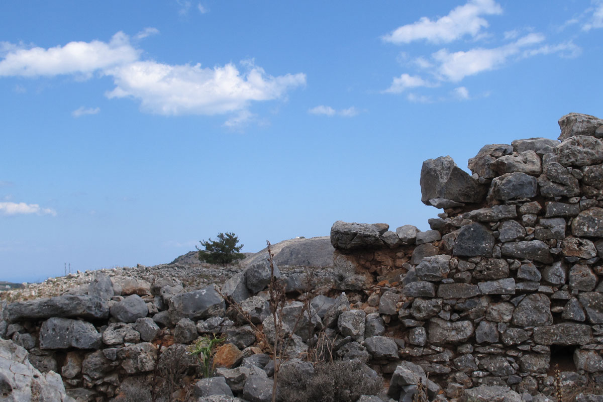
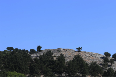
Agios Dimitrios: West of the village of Anopoli and east of Aradena, at 35 13’ 27.04” N 24 04’ 18.46” E at 645 m elevation, within line of sight of Agia Ekaterini and Agios Ioannis forts there was another fort, possibly built there to maintain watch over rebel movements across the Aradena gorge and over the western areas of the Anopoli plateau. The ruins indicate that it might have been of a reasonable size to house a number of troops on a more permanent base but this depends on the size of the fort at Agia Ekaterini that is only 2 km away.
Fort ruins at Agios Dimitrios
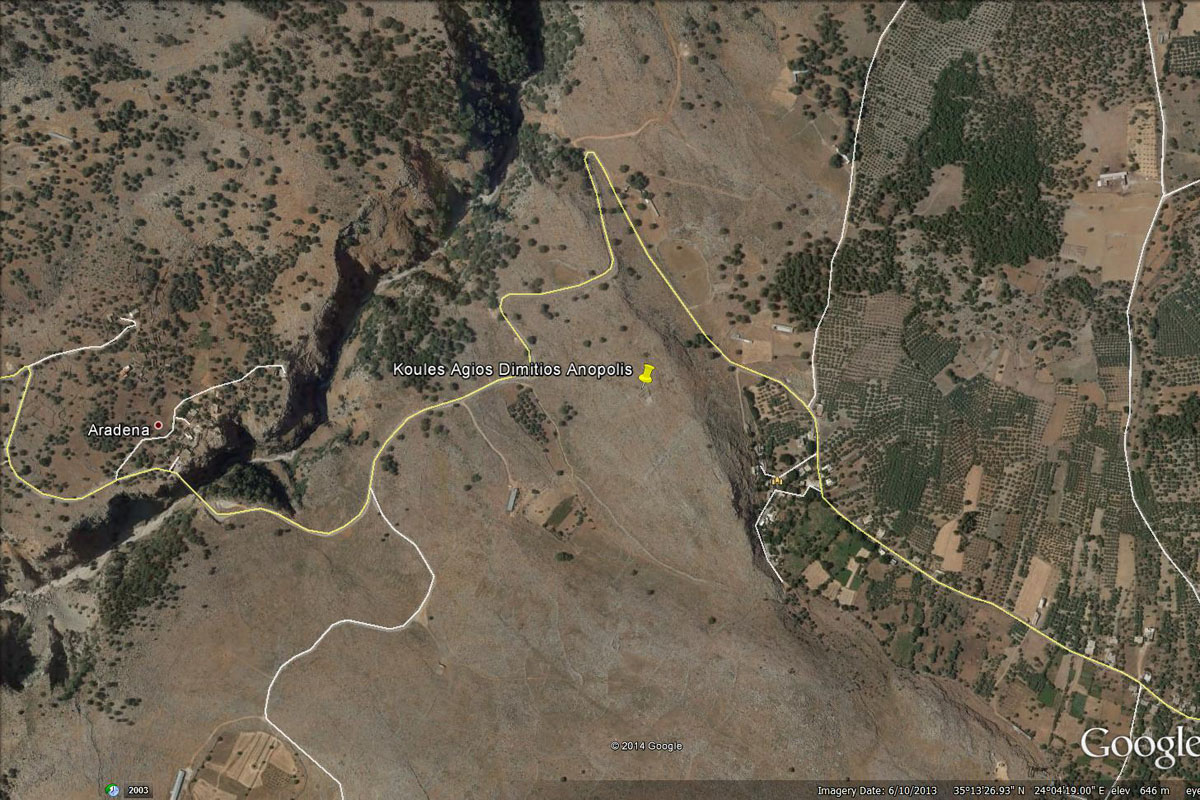
Satellite view of the location

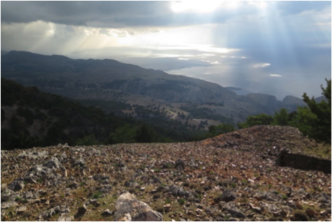
View towards the forts above Agios Ioannis
View of Agia Ekaterini far in the background
Agios Ioannis: Above the village of Agios Ioannis there are the ruins of a fort as well an observation post. The observation post is at 35 13’ 52.25” N 24 01’ 39.86” E at 1014 m elevation and the fort 500 m northeast of it, at 35 13’ 56.63” N 24 01’ 57.41” E at 1070 m elevation
Fort view from a southern approach
View of Anopoli plateau from the fort
View of observation tower from fort
View west from observation tower
The fort was a more substantial structure, although completely ruined now, but one can still see the water collection and storage tank nearby. The function of the observation post must have been to provide a view over the village of Agios Ioannis and the approach to the fort from the south, in case of imminent rebel attack. Three of the forts at Agia Roumeli are in clear line of sight of both the observation post and the fort (the lower western fort at Agia Roumeli is obscured by the eastern ridge of the Samaria gorge).
The map below indicates the line of sight links between the forts and observation posts between Chora Sfakion and Agios Ioannis. The line to the right is indicating the link to Kefala and the one to the left to the Agia Roumeli forts.
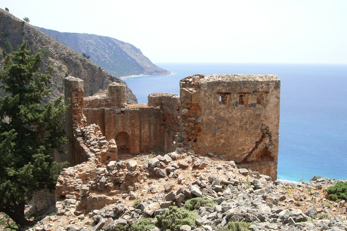
Agia Roumeli: At Agia Roumeli, a place where the Turks had found almost impossible to defeat the Sfakians, they built four forts, two on either side of the entrance to the Samaria gorge, as well as another one above the Samaria village and one at the northern entrance to the gorge, at Xyloskalo.
The two forts on the eastern side of gorge are at 35 14’ 23.2” N 23 58’ 24.2” E at 638 m elevation for the larger fort and some 400 m SW of this at a lower elevation at 35 14’ 14” N 23 58’ 14.6” E at 533 m. Both are in ruins but indicate being of substantial construction for stationing there permanent troop numbers The line of sight to the east towards Agios Ioannis from both forts has been confirmed. The two forts on the western side of the gorge are also within sight of the eastern forts.
The two eastern forts as seen from the northern approach from Angelocamboi.
Upper eastern fort
View towards Selouda and Agios Pavlos
Lower eastern fort
The two eastern forts are located on the two peaks on the near ridge in the picture above. In the far distance there are the two peaks of the Agios Ioannis forts
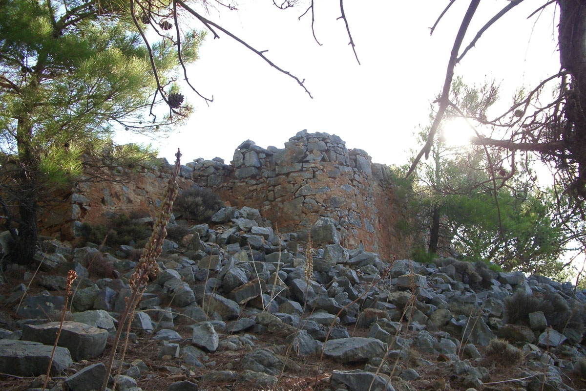
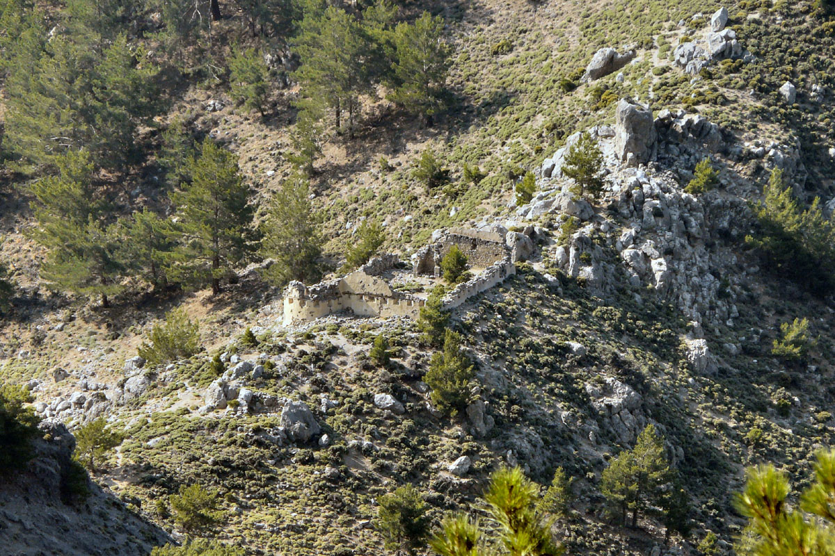
The two forts on the western side of the gorge are at the following locations. The lower one is the larger fort of the four in the area and it is at 35 14’ 01.7” N 23 57’ 37.9” E at 194 m elevation while the upper one is much smaller and is at 35 14’ 13.7” N 23 57’ 17.3” E at 529 m elevation. The lower fort, similarly to the one at Loutro, is fairly substantial, at least two stories high with internal walls dividing the building into a number of functional areas. It has tourist potential but again this will require substantial funding. The upper fort is much smaller, possibly being just an observation post, manned by troops from the larger lower fort.
Lower west fort
Upper west fort
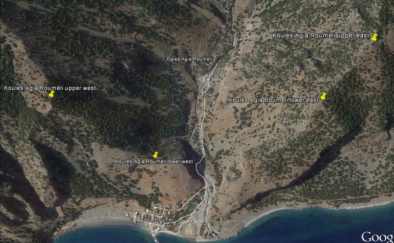
Satellite view of the location of the four forts and the entrance to the Samaria gorge
From the Agia Roumeli forts there is no clear line of sight towards the west due to the high ridges between Agia Roumeli and the ridge above Tripiti gorge where the next fort was built. Similarly there is no line of sight to the fort built in the gorge above the Samaria village. Both these forts had separate lines of communication, as we will examine below.
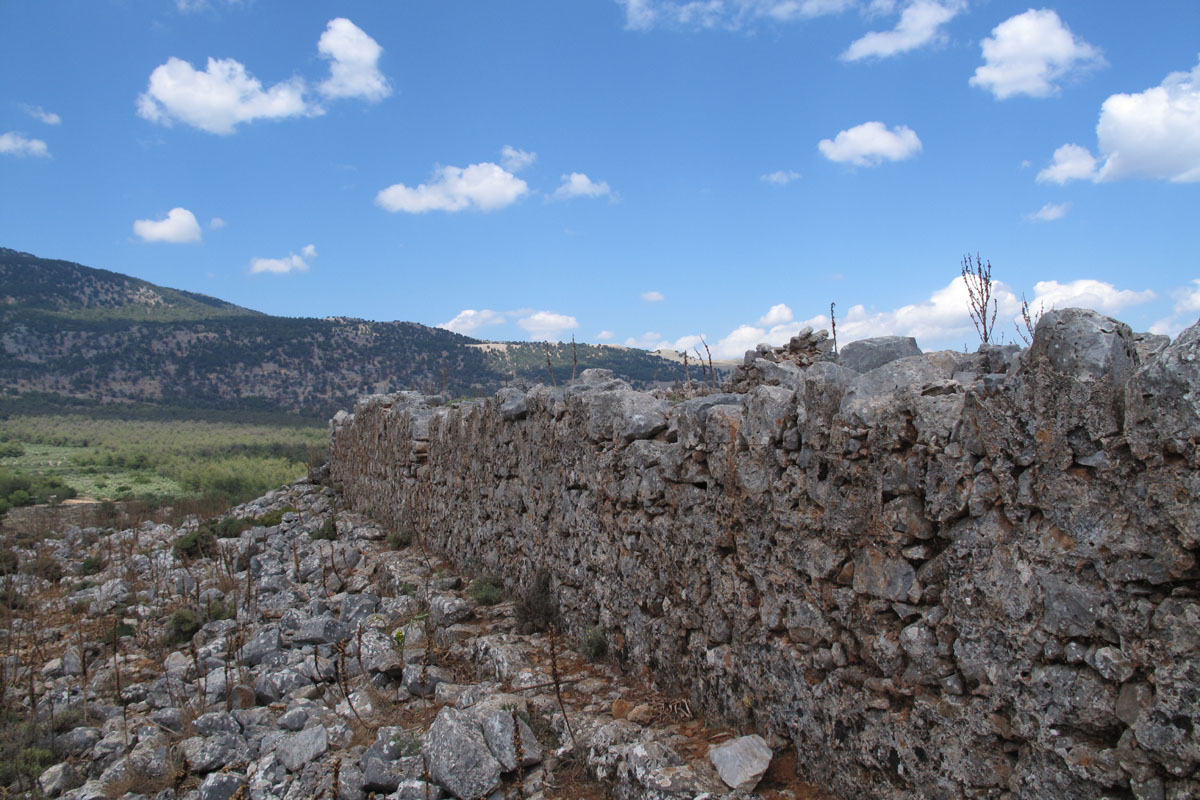
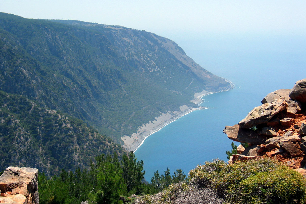
Tripiti / Pikilassos: Some 9 km to the west of Agia Roumeli, on the ridge above the Tripiti gorge and near the old city of Pikilassion or Pikilassos, the Turks built another large fort to oversee any rebel movements through the Tripiti gorge. This was not in a line of sight to any of the forts to the east. It is believed that access to this fort was either from the north as there are paths that link this area to Koustogerako or through the path west to Sougia and had a line of communication to the west, to Sougia, from an observation post, possibly from the location of where today is the chapel of Profitis Illias, at the southern tip of the ridge. Such a post would have also enabled the Turks to monitor any rebel movements approaching that area. Captain Spratt who passed through this area in 1852 did not report the existence of such a chapel there, so it is possible that once the Turks left the area the Sfakians built a chapel in its place.
The fort is located at 35 14’ 32.8″ N 23 51′ 57.8” E at 305m elevation and although ruined, it is quite evident that it was of a significant size to house a large permanent garrison and it is again two stories high with internal walls dividing it internally into certain functional areas.
Tripiti fort ruins
Profitis Illias above the Tripiti gorge
View to the west from the fort
View of Sougia from Profitis Illias
The pictures above indicate the strategic position of where today’s chapel of Profitis Illias is located (top right hand picture, white dot at the top of the ridge), while the two lower pictures indicate that only from the chapel’s position Sougia can be seen, where the next fort was, some 5 km away.
Sougia: This area has not been explored yet to determine where the location of the local fort was with direct view of Tripiti and the Chapel of Profitis Illias. Although this is outside Sfakia it needs to be determined to close the line of communication from the Turkish forts in Sfakia to a location outside Sfakia that eventually connects to the north of the island
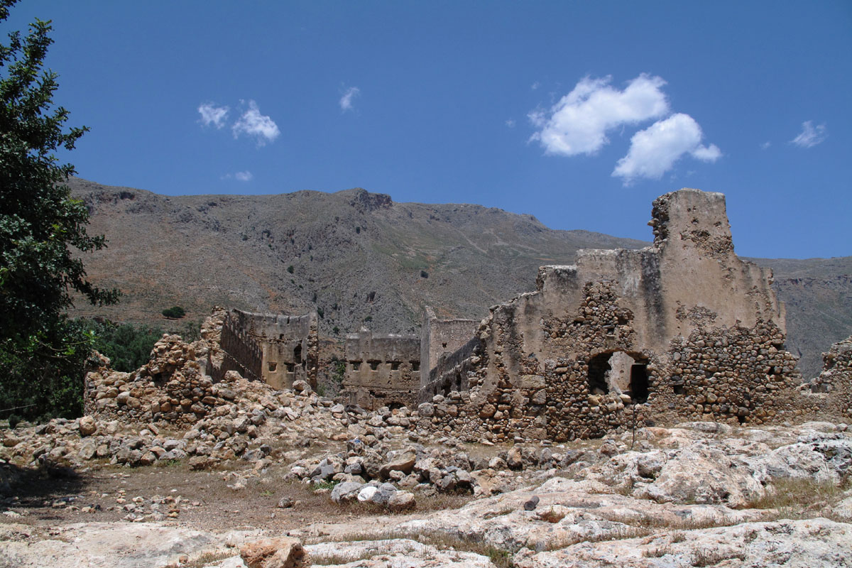
Now we come back to the last fort built by the Turks in Sfakia, in the heart of the previously unconquered Samaria gorge, just above the Smaria village.
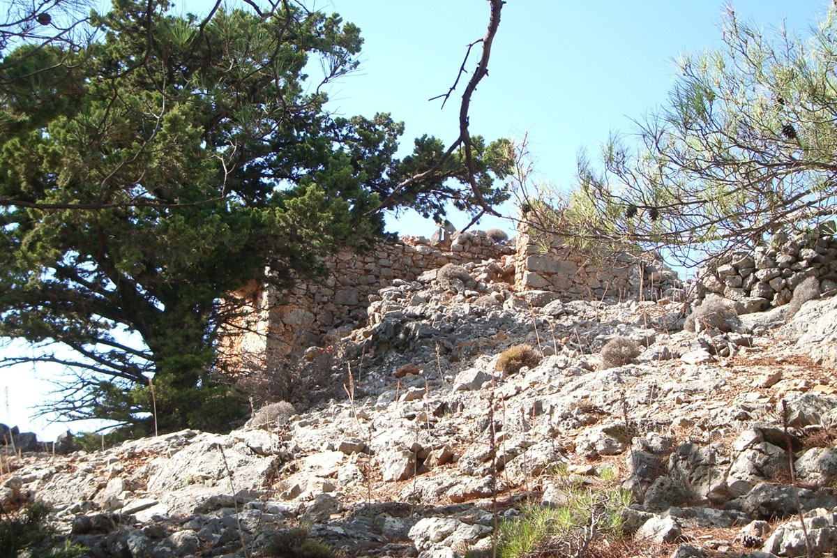
The Samaria village fort is above the village in a NE direction, about half hour walk from the village at 35 17’ 43.48” N 23 57’ 35.03” E at 515 m elevation. This fort had a direct line of view to a fort at Xyloskalo, the northern entrance to the Samaria gorge which in turn was linked to a series of forts on the Omalo plateau and from there to Lakkoi. This is also ruined but its size indicates that it was built to house a permanent garrison which was supported by troops from the Xyloskalo and other forts from the Omalo plateau.
Samaria village fort
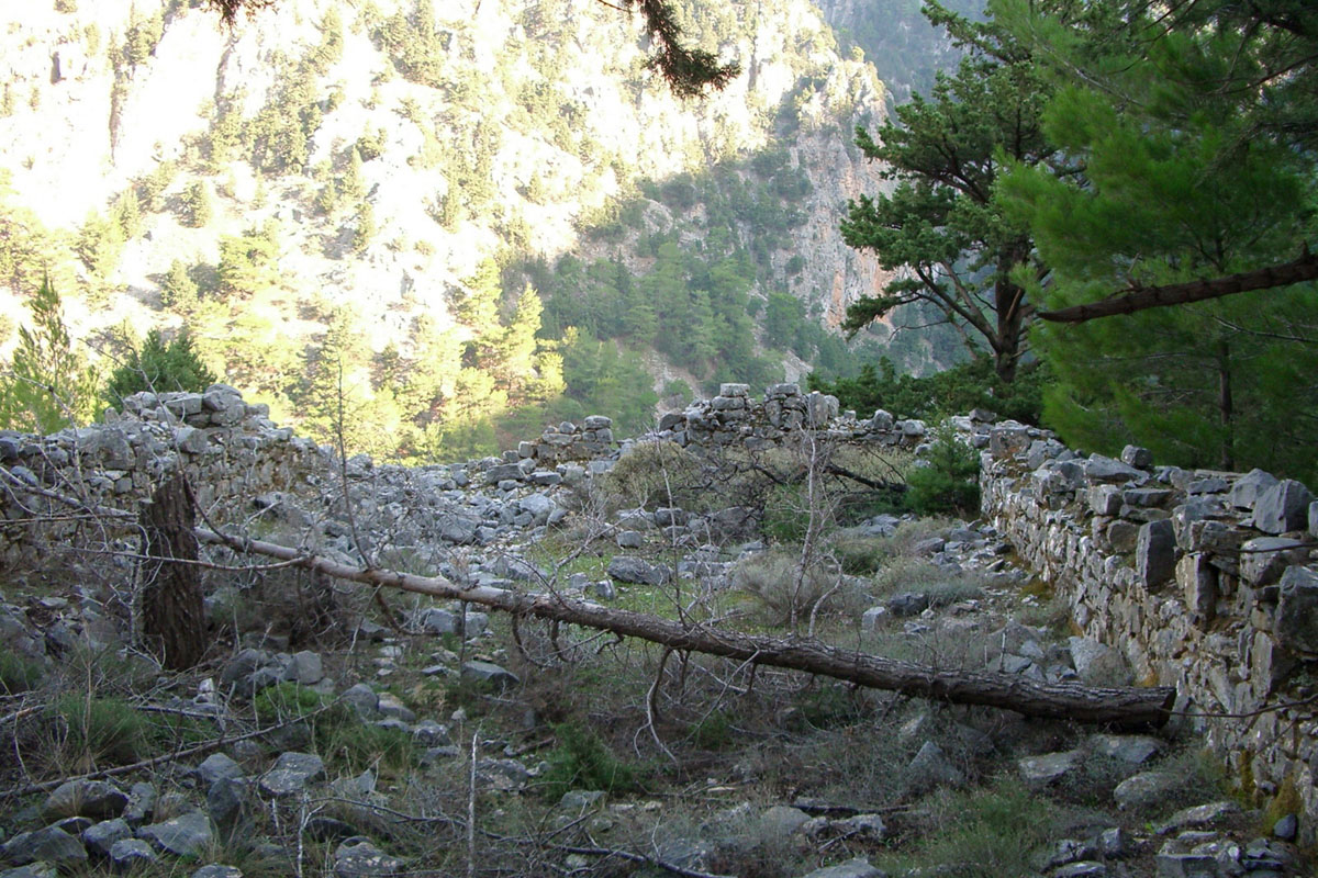
Interior of the fort
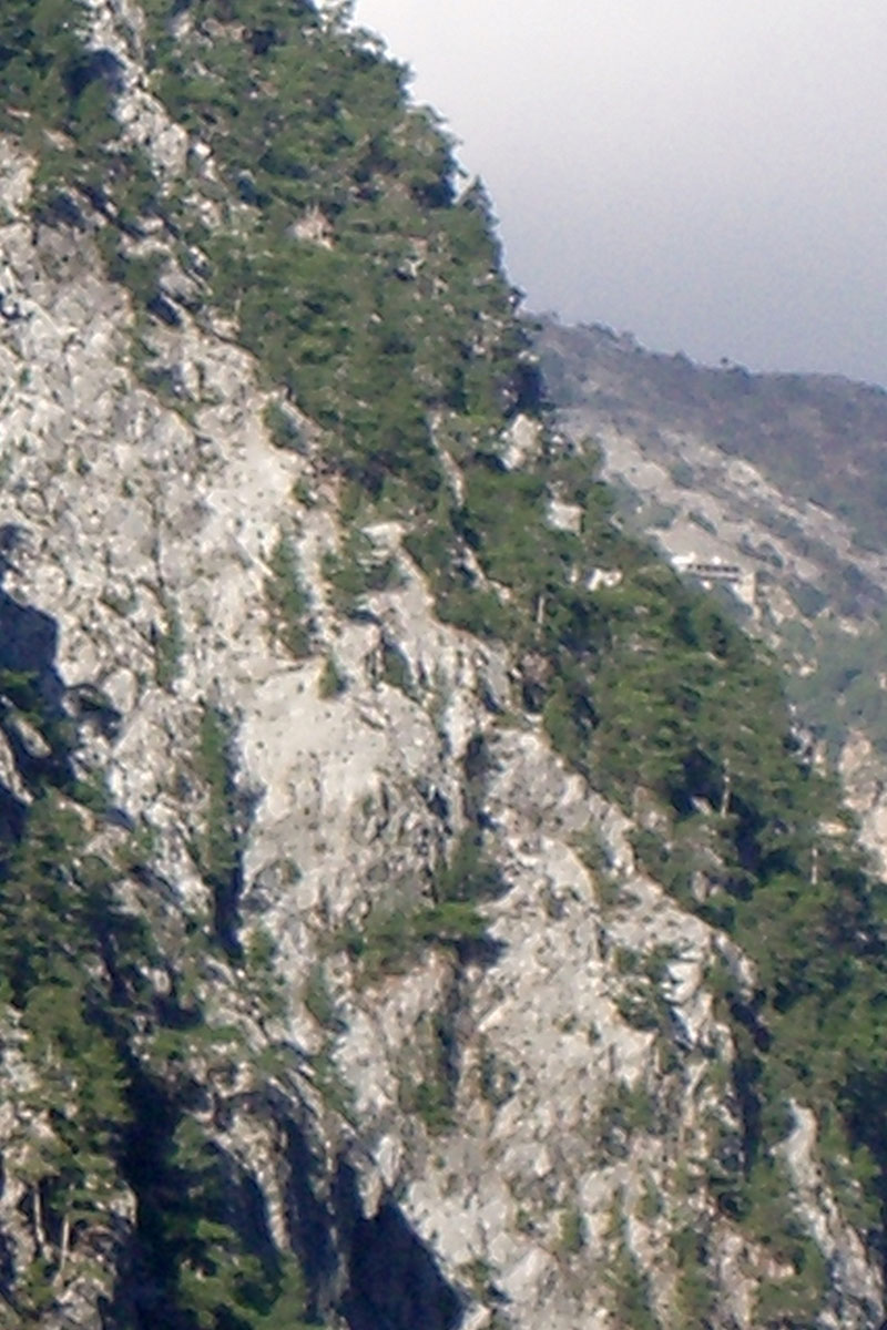
The Xyloskalo tourist building view from Samaria fort
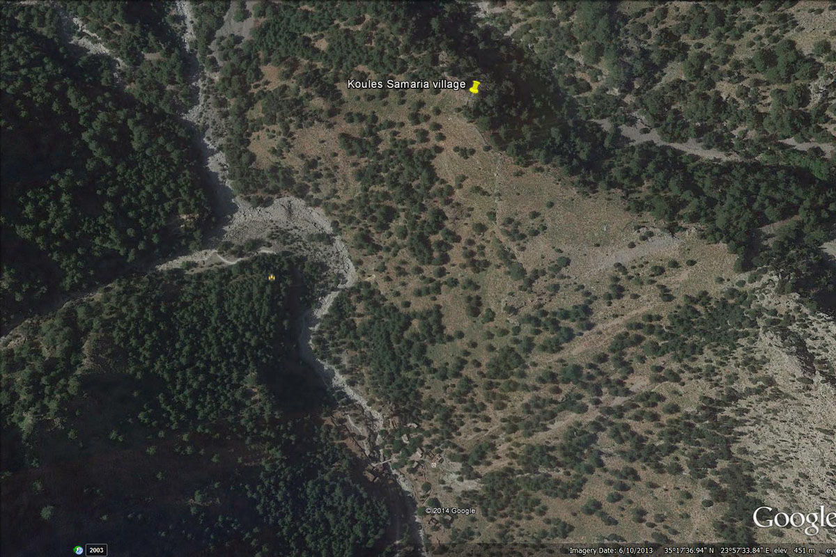
Satellite view of the fort and the village
At Xyloskalo there was a fort to maintain communications with the Turks that were stationed above the Smaria village. This was located on the first turn towards the track to Linoseli according to Plymakis. (Possible location near 35 18’ 27.76” N 23 55’ 02.23” E). A recent visit to this area was unsuccessful in locating any ruins which is understandable given the works in building the tourist establishment and the pathways in the area. This fort was the first in a line across the Omalo plateau in the direction to Lakkoi with a possible next fort in line to be one at Koukoules or Pyrgos (both names appear in different Anavasi publications) at 35 20’ 24.34” N 23 54’ 21.03” E at 1105 m elevation providing direct line of sight. This requires confirmation.
Historical background for their establishment:
Following the suppression of the 1866-69 uprising in Crete a new strategy for conducting the war against the rebels was attempted by the Turks on the recommendation of a British former naval officer, Hobart-Hampden,[1] who was then in the employ of the Ottomans. The Turks began building a chain of forts within sight of each other; this would enable them to keep an eye on rebel activities in known insurgent areas and monitor where outside help was coming in. There were 150 such forts built throughout Crete during this period; Sfakia, a rebel stronghold, had twenty. Some were fairly large and contained permanent garrisons, while others were simply small observation posts.
Their subsequent utilisation of the forts in Sfakia was rather brief and did not succeed in stopping the Sfakians from attacking them on the first opportunity. Details of their eventual destruction are very sketchy; just ten years later, in 1879, there is a report that Frangokastello had been abandoned by the Turks and that the forts at Askifou, Imbros and Chora Sfakion had been destroyed during the 1879 uprising. The lower fort at Chora Sfakion was reinstated as there is a report from 1893 with a picture of Turkish soldiers outside the fort. What forts had remained occupied must have been abandoned soon after by 1898 when the Turkish troops left Crete.
Study participants and other contributors
As mentioned at the beginning of this presentation, there have been a number of people that have participated in this study whom I would like to acknowledge their contribution and to thank them. Without their assistance this study would not have reached to this point. Those that have walked to some of these forts and have provided photographs and information have been Jean Bienvenu, Denis Coghlan, Irene Gilbert, Michael Katzko, Ray Langsten, Mary Patterson and Simon Stutz. Information has also been provided by Kanakis Geronymakis, Antonis Plymakis, Roussos Viglis and Damoulis Votzakis.
Any further contributions to this study to close the many gaps that still remain would be greatly appreciated.
April, 2015
[1] Αιμιλία Κλάδου-Μπλέτσα, Χανιώτικα Νέα, 17 & 18 Δεκεμβρίου 1993
[2] Πλυμάκης Αντώνης, Μνήμες Σαμαριάς, Χανιά 2010
[3] Κανάκης Γερωνυμάκης, Χανιώτικα Νέα, 14 Φεβρουαρίου, 1999
[4] Augustus Charles Hobart-Hampden, a former British Navy officer who entered the service of the Ottomans in 1867. He was immediately given command over the Ottoman fleet to help suppress the insurrection in Crete and was rewarded by the Sultan with the title of Pasha in 1869.